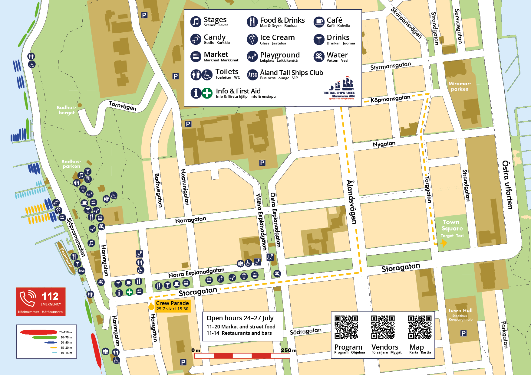
MAP OF THE EVENT AREA
Mariehamn is easy to discover by foot. It is only a ten-minute walk trough the Esplanade from one harbour to the other.
All ships during the Tall Ships Races 2024 will be moored within a 1 km area in the western harbour. Close to Ålands jewel, the sailing ship Pommern.
For more information about vendors, street food and servings visit our page Food and market. If you want to know more about what's happening on the stages and activities in the event area, please read our Program.
Open hours for the event area
11–20 Market and street food
11–24 Restaurants and bars
Printable map
Do you want the event map as PDF-document or to print on paper? Click on the link below.

All ships by name on our Google Map
For all icons, you can request directions via Google Maps, directions from where you are right now.
Each icon with a sailing ship represents a ship in the Tall Ships Races. For the larger ships (red, green and some of the blue icons) you can read more about them by clicking on the icon or in the menu. There is a photo, the name of the ship, country, year built and the class the ship competes in.
You can also find these ships via the search function on the map. For example, enter the name for Guayas. Or if you need water, info or WC you can search for that.
